12 January 2018

Gariep Dam, Port Elizabeth, Storms River, Camdaboo and Bloemfontein - December 2017

Gariep Dam, Port Elizabeth, Storms River, Camdaboo and Bloemfontein - December 2017


December 2017 we decided to camp at Storms River Rest Camp, within the Tsitsikama National Park.
Our trip would be with the Chevrolet Trailblazer towing our Jurgens Avion L caravan.


The round trip was as follows


We were leaving on a Monday, but as we did not have far to travel decided to take a more relaxed start and leave at about 11am. The trip was straight down the N1 past Bloemfontein and onto the Forever Resort at Gariep Dam.

According to Wikipedia : The wall is 88 m high and has a crest length of 914 m and contains approximately 1.73 million m³ of concrete. The Gariep Dam is the largest storage reservoir in South Africa. In South African English, 'dam' refers both to the structure and the lake it impounds. Gariep Dam has a total storage capacity of approximately 5,340,000 megalitres (5,340 hm3) and a surface area of more than 370 square kilometres (140 sq mi) when full. The hydro-electrical power station houses four 90 MW generators, giving a maximum output of 360 MW of electricity at a water flow rate of 800 m³/s.

As can be seen from the picture, the dam was rather low on water. In fact, the entire country seems to be in a drought situation.


We were to stay at the Forever Resort - Gariep Dam, in one of their camping sites with a private ablution facility. However, I decided to upgrade to a chalet and we had a very nice unit. We were also able to park the caravan just near the front door. 

According to their website, Award-winning Gariep, A Forever Resort is the perfect stopover between Gauteng and the Cape, 180 km South of Bloemfontein, just off the N1. The Gariep Dam is the largest dam in South Africa, bordering three provinces namely Free State, Northern Cape and Eastern Cape.


This is the chalet that we had. They have all been refurbished since we last stayed there and were in good condition.


The caravan park is also very nice and has loads of trees and nice facilities.


There are two routes which you can take to get to PE. One is back to the N1 and then through Colesburg and onto the N10 down to PE. The second if to cross over the dam wall and progress on the R33, onto the R58 and then onto the R390 and Steynsburg and Hofmeyr. This road joins the N10 at Cradock.

We decided to take the more leisurely route through Steynsburg and Hofmeyr. There is not much in Steynsburg and their website advises : Founded in 1872, this little town of some 400 plus households, situated deep in the sheep farming territory of the Eastern Cape’s Karoo and nestled in a ring of mountains and koppies, is being re-discovered by people looking for a different lifestyle. Property prices here mean that this is one of those destinations where you can actually afford that country home you had only dreamt about before.

We passed through and made steady progress onto Hofmeyr. According to Wikipedia, Hofmeyr is a small Karoo town in the Eastern Cape Province of South Africa, 20 km west of the Bamboesbergmountain range. It lies 64 km north-east of Cradock at an altitude of 1,252 metres. According to the 2011 census, the population of Hofmeyr proper is about 326 persons and the neighbouring township of Luxolweni is about 3354. In former times it lay at the centre of a flourishing sheep-farming district and managed some salt pans 10 km to its west.


With even less to do in Hofmeyr we progress onto Port Elizabeth, also known as Nelson Mandela Bay.

According to their site, Nelson Mandela Bay (Port  ElizabethUitenhageDespatch and Colchester), an excellent value-for-money-family-fun-in-the-sun-holiday destination, named after Nelson Mandela - humanitarian, freedom fighter and world icon of peace - is located 763 km east of Cape Town, is regarded as the "official" gateway to the scenic Eastern Cape Province and the world renowned Garden Route and is sometimes referred to (by the people who know her best) as the "friendly city" or the "water sport capital of Africa". Nelson Mandela Bay is also recognised as both the Mohair and Bottelnose Dolphin Capital of the World and is home to the largest breeding colony of the African Penguin.

Pine Lodge Resort is situated just on the outskirts of PE and in the Cape Recife Nature Reserve.
I thought that I had booked one of their luxury caravan sites. However it turned out to be a site with a huge boma, and nothing else. So I went back to reception and changed it for an ordinary site. Pine lodge is very nice and the ablutions were clean and tidy. The ablutions are in wooden buildings and they are kept locked. We had sufficient hot water and a very nice relaxing time.


Whilst in PE we decided to have a break from cooking and have a meal at the Barneys Tavern restaurant. This restaurant is on the beachfront and overlooks Hobie and Humewood beaches. A fantastic setting.

We had to leave the next morning and make our way down the N2 to Stormsriver. We were camping, for a few days, at the Storms River Mouth rest camp. This is a SANPARKS venue.
Storms River Restcamp, is described by SanParks as :Where the booming breakers of the Indian Ocean relentlessly pound rocky shores, where temperate high forest and fynbos roll down to the sea in an unspoilt verdant carpet, where ancient rivers carve their paths to the ocean down rocky ravines.
This, "the place of much water", is the Tsitsikamma Section of the Garden Route National Park. The heartland of the park stretches some 5km to sea, protecting a wonderland of inter-tidal life, reef and deep-sea fish.
Dolphins frolic in the breakers, surfing and playing for the sheer joy of life, and the gentle giant of the ocean, the southern right whale visits here, coming inshore to breed.
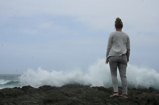
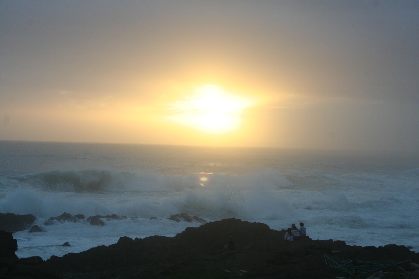
We had a lovely campsite there and had a wonderful view of the ocean. The waves broke on rocks about 10 meters from our site. We also did see the dolphins.


Whilst there, we went through to George for a day. This was because our daughter, Elizabeth was talking at Hope Church in George - this was with regard to her work at Village Of Hope in Mongu Western Zambia. 

George was good and we stayed over the night. We visited Victoria Bay which is really lovely. They have a fantastic caravan park. We have stayed there previously.


Back at Storms River, one of the days was a little cooler so my daughter and I decided to take the walk to the waterfall. Its advertised as a walk for those that are a little fit. Its 3.5km's each way. We started out on a very nice gently partway. All to soon, the pathway dissipated and you had to clamber over rocks. There was no sign of any path, just a few orange markings on the rocks every now and again. These depicted the way. It was quiet strenuous and after a few hours we finally arrived at the waterfall. I must say that it was quiet spectacular and worth the walk. A nice pool at the bottom of the waterfall was protected from the sea by a few rocks. We sat there for a while and then made our way back. Was a good walk !


We had a great time at Storms River. 

Just a couple of random shots of Storms River.


But all too soon it was time to pack up and head homeward bound. But we were not going back to Johannesburg, we had booked at Camdeboo National Park. This park is just on the outskirts of Graaff Reinet. The area was very hot and dry.


To get to Graff Reinet from Storms river you have a few options. The two that we were considering were heading back along the N2 to Port Elizabeth and then going R334 to Uitenhage and onto the R75 up through Jansenville to Graff Reinet.

Our option was to travel through the Langkloof, turning off the N2 (travelling in the direction of Port Elizabeth) and heading to Kareedouw along the R62 (Route 62) and then turning onto the R336 and then the N9 at Uniondale  and progressing through Willowmore and Aberdeen before driving through Graaf Reinet and arriving at the Camdaboo National Park 


The camping sites were empty when we arrived so we were able to choose our own site. Luckily we got one with some shade.

We were camping there for two nights. We took a drive around on the game drive tracks and we did see a few species of game. The dam, called the Nwqeba Dam did not have much water, but there was a little.

The caravan park has really nice ablutions. There is also a deck for the campers. This is a raised deck from which you can see most of the dam. The campsite is fenced.
The Vervet monkeys were around and a little of a nuisance. Although they tried to pinch the tinfoil that we had left out, nothing else was taken.


The dam was almost empty, but you could see a small patch of water in the distance. We also did see a few animals while driving around.


We left Graff Reinet on the N9 and joined the N1 at Colesberg. We stopped for some diesel and also a quick something to eat at the Wimpy. From Colesburg its up the N1 to Bloemfontein.
We left Camdeboo and were travelling to a caravan park just on the outskirts of Bloemfontein. We had a pleasant drive back up, but the road was hectically busy with all the Gauteng  holiday makers making their way down to their coastal holiday destinations. Luckily the constant stream was going down and we were on our way back up.

The caravan park the we had chosen to stay was called River of Joy. It is quiet close to the highway, but we heard no traffic. The ablutions are a bit old, but they are very clean and supplied with hot water. The wash up facilities were a bit dilapidated, but still ok. We had electric power, shade and grass. It was only for 1 evening and served us adequately. Actually, the park filled up and most of the sites were taken for the evening. We would stay there again.

There were also a few long stay residents there.
The park has some geese and the turkey who roam around.


We left the next morning, and were home quiet early. We continued along the N1, passing through Ventersburg, where we decided to stop for diesel as it would be quieter than the only petrol stop in Kroonstad. This turned out to be a great decision.


We were home in Johannesburg just about lunch time.


Another superb holiday and a relaxing time.

09 October 2017

Waterberg Wilderness Reserve - October 2017

Camping at the Waterberg Wilderness Reserve - October 2017


We (John, Anne Sue and myself) decided to try a camping weekend at a park where there was to be no electric power. John wanted to see if his solar panel worked ok and I wanted to check if my battery system would work my fridge for the entire weekend. My freezer in the camping trailer works on 12v, 220 and gas. So that ran off gas the weekend.

For this, we decided to book at Waterberg Wilderness Reserve. The website looked good, so we made the booking a few months ago.

Waterberg Wilderness describe the park as :
The Waterberg mountain range is situated in the Limpopo province of South Africa and is one of the more pristine, scenic and wildlife rich areas in South Africa. Positioned on the Eastern side of the Waterberg range the Waterberg Wilderness reserve is only 5 hours from Johannesburg and conveniently positioned half way to Botswana. Due to the rugged nature of the reserve which is typical of the Waterberg, a 4×4 vehicle or vehicle with good ground clearance is recommended to access the property. In the wet season a 4×4 vehicle is often essential.
Certain areas of the Waterberg Wilderness Reserve offer spectacular views over the surrounding hills and valleys and exploring the impressive gorges with natural streams and pools is certainly a highlight. The reserve is ideal for the more active with some beautiful walks and potential mountain bike trails.
The game lodge offers accommodation in the Waterberg Wilderness camp but is exclusive and can only accommodate a maximum of 12 guests in the 4 safari tents with an additional 2 campsites available. All accommodation is self catering with comfortable and complete facilities.
All game drives are in your own self drive 4×4 vehicles.

In another section of the website, it explains that the park is only 2.5 hours from Johannesburg. I checked on Google maps and my Garmin, and yes, it was 2.5 hours. So we were sorted.

Sue and I left Friday morning and made our way, slowly as there was no rush, to the park. We arrived at about 12h30 and checked in. The dirt road up to the gate is ok, but it has some bad sections,. You definitely will not get in with an ordinary vehicle.  
We were directed to our site and soon settled in to a comfortable weekend.


It was so nice to have peace and quiet. The sites have private ablutions and the water is heated via a gas geyser. So no problems there.
The camp staff are extremely friendly, pleasant and anything that we asked was taken care of immediately and without any fuss.
Another very nice thing about the reserve is that the sites are a long way apart and private. So even if there were other campers, we would not have seen them from our campsite. The reserve also has safari tents where each tent has a built in bath and shower. A fully equipped kitchen as well as a braai area. Oh, there is also an outside shower, private and with a view of the bush. Looked lovely.

We were camping in Bee Eater private campsite. It was large enough for two (or more) camping trailers and we were not even on top of each other, fantastic !


Each afternoon braai wood was delivered by an old Massey Furguson tractor.

We enjoyed two very pleasant braai's, one Friday and the other Saturday evening.

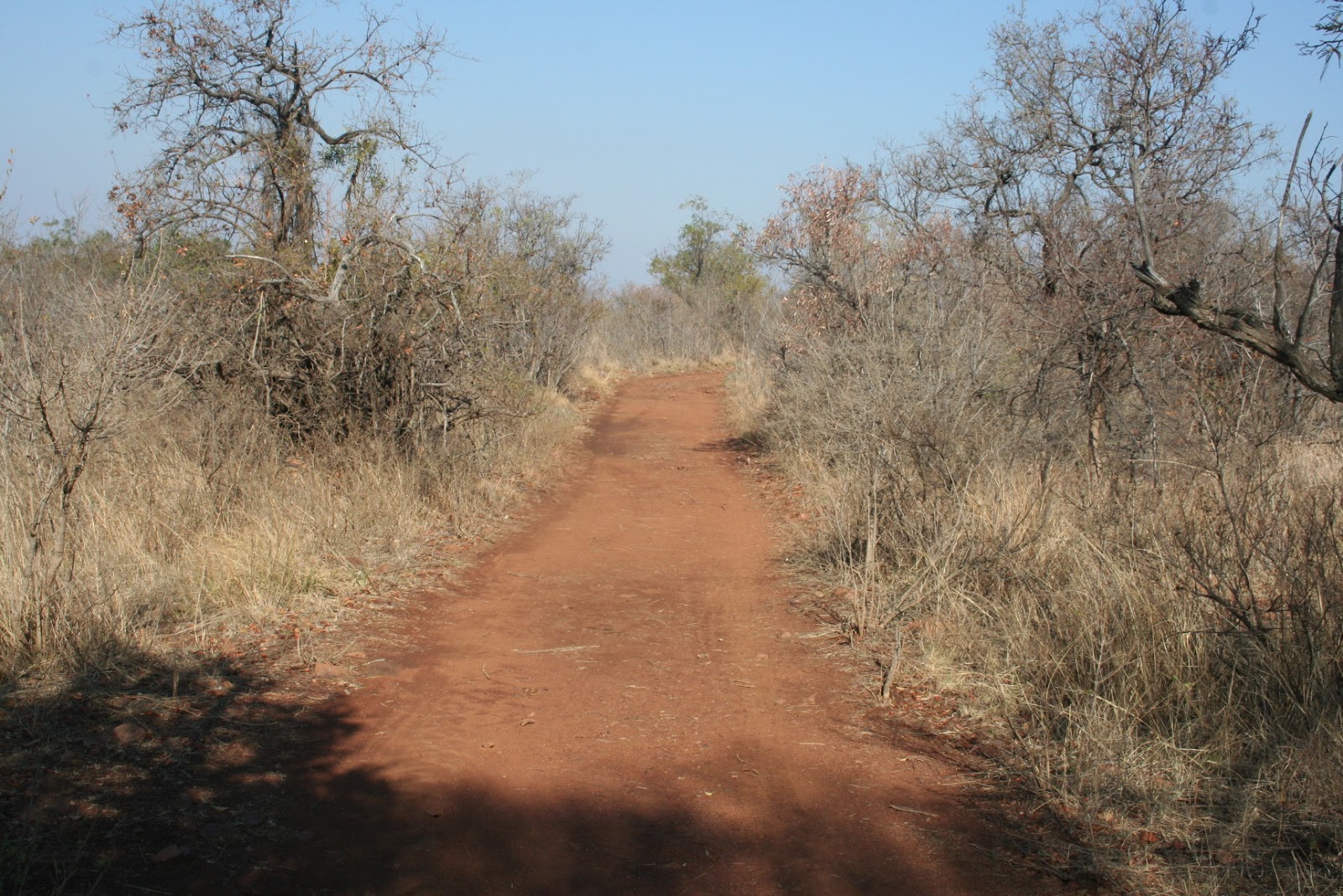
On the Saturday we went for a drive around on the 4x4 tracks, We were provided with a very comprehensive map and each intersection is marked by a rock with a number pained onto it. The roads were actually in a good condition and not bad at all.


We did see some of the game that is on the farm. Giraffe, Zebra, Kudu, Nyala and Wildebeest. There are others, but we did not see them. Also did see a few bird species as well.

On the Sunday we went for a drive to a view point.

It did not look like much from the parking spot, or from the path leading from the signpost.
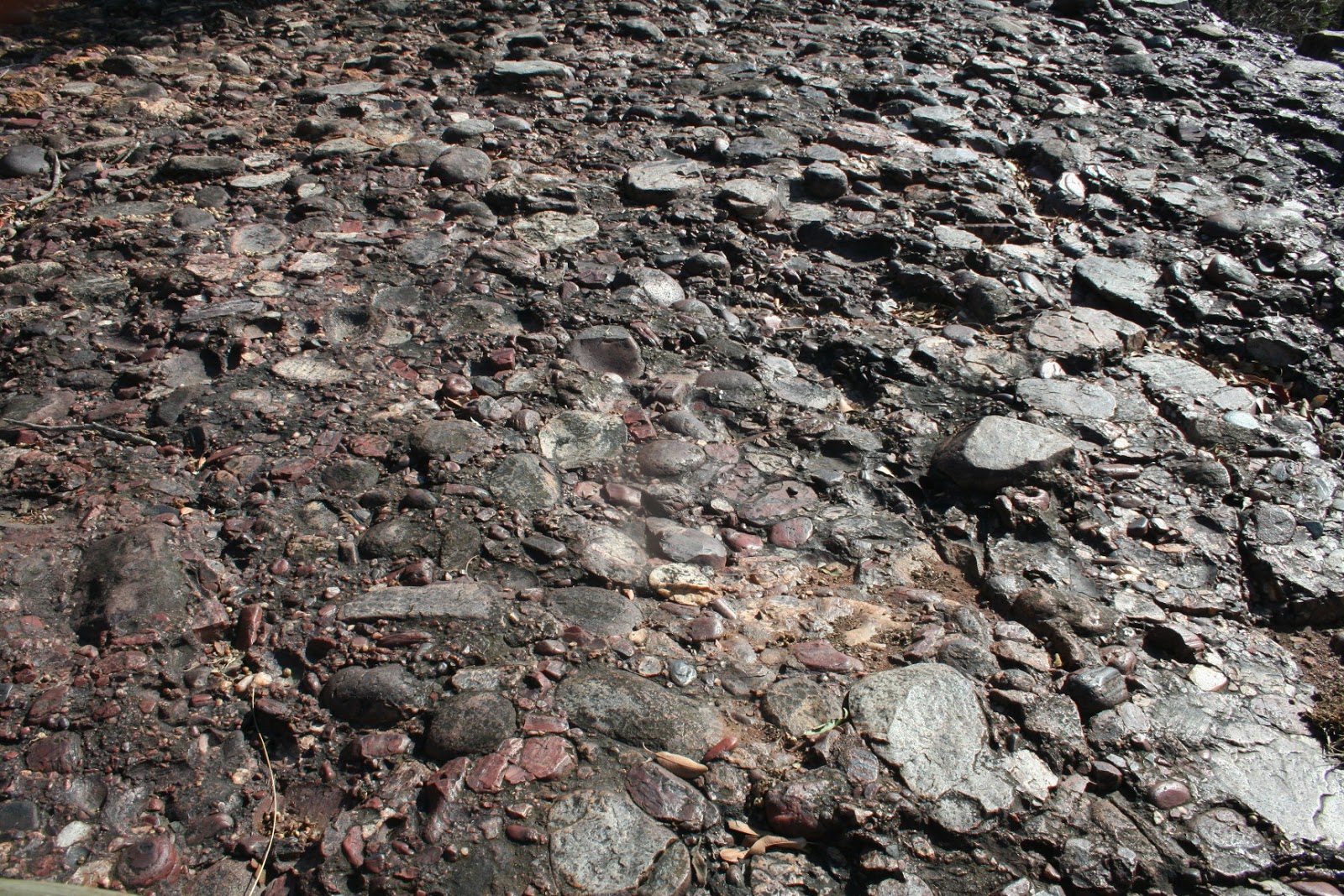
But, when we got there, the cliff was actually made up of conglomerate. According to the web, conglomerate rock is :
Conglomerate ( /kəŋˈɡlÉ’mÉ™rɪt/) is a coarse-grained clastic sedimentary rock that is composed of a substantial fraction of rounded to subangular gravel-size clasts, e.g., granulespebblescobbles, and boulders, larger than 2 mm (0.079 in) in diameter. Conglomerates form by the consolidation and lithification of gravel. Conglomerates typically contain finer grained sediment, e.g., either sandsiltclay or combination of them, called matrix by geologists, filling their interstices and are often cemented by calcium carbonateiron oxidesilica, or hardened clay.
The size and composition of the gravel-size fraction of a conglomerate may or may not vary in composition, sorting, and size. In some conglomerates, the gravel-size class consist almost entirely of what were clay clasts at the time of deposition. Conglomerates can be found in sedimentary rock sequences of all ages but probably make up less than 1 percent by weight of all sedimentary rocks. In terms of origin and depositional mechanisms, they are closely related to sandstones and exhibit many of the same types of sedimentary structures, e.g., tabular and trough cross-bedding and graded bedding

It was actually quiet spectacular and the view down into the valley was also great. We were pleased that we had made the effort.


We also took the opportunity for a few "people" photographs.


Well, that was Sunday morning and we returned to the campsite for a very nice breakfast of bacon, sausage, eggs, brinjal and mushrooms as well as toast. Was good.
Thereafter we packed up slowly and made our way back home. Unfortunately you have to travel along the N1 and the drivers were driving like fools. passing in the left emergency lane. One fellow was just driving, fast, in the emergency lane for km's on the N1. They also try to push other vehicles off the road. But, luckily, we all made it home safely.

Was another lovely weekend camping !!

21 August 2017

RADAR - GPS Tracking Made Easy

RADAR - GPS Tracking Made Easy


Radar brings you the simplest GPS tracking mechanism yet. Keep tab on your assets in your web browser or on your Android device with our new app.
gps tracking get radar getradar icasa Durban South Africa Cape Town Johannesburg geofencing geo-fencing


Track Your Vehicle

With updates every minute, you can have peace of mind as you know where your vehicle is at all times.

gps tracking get radar getradar icasa Durban South Africa Cape Town Johannesburg geofencing geo-fencing

Vehicle History

The ability to look up a detailed history of your vehicle's travel paths and speed.


gps tracking get radar getradar icasa Durban South Africa Cape Town Johannesburg geofencing geo-fencing

SMS Alerts

The panic button functionality allows you to alert designated people to any emergency you may encounter.

gps tracking get radar getradar icasa Durban South Africa Cape Town Johannesburg geofencing geo-fencing

Geofencing

Set geographical boundaries and be alerted when a vehicle leaves the perimeter.

gps GPS tracking get radar getradar icasa ICASA

gps GPS tracking get radar getradar icasa ICASA

Specifications


Dimensions:72 x 50 x 25 mm
Weight:50 grams
Enclosure:ABS Thermoplastic
Operating Temperature:-20 to +70 degrees C
Humidity:< 96% (Non-condensing)
Power Requirements:5, 12 - 24 V DC
Battery:1100 mAh 3.7 V Li-ion Polymer

Possible Uses for the Radar GPS Tracking Device

TRACKING FOR :

1)    4x4 Overland Safari
2)    Africa continental travels
3)    Vehicle rental companies
4)    Safari vehicles
5)    Trailer hire companies
6)    Off-road caravan rentals
7)    Caravan rentals
8)    Construction company vehicles
9)    Mining vehicles
10)  Boats
11)  Yachts
12)  Water craft
13)  Recovery vehicles
14) Taxi vehicles
15) Family vehicles
16) Assets tracking

In fact, Radar can be utilised for any and all vehicle/asset tracking and provides peace of mind and easily viewable route and location

Get RADAR and ensure that when your vehicle breaks down in a remote area you know that someone will be able to locate you.
Also used for asset tracking and monitoring.

ASSET TRACKING ON THE INTERNET - COMPUTER / SMART PHONE
SOLAR POWERED / VEHICLE CHARGER / MAINS CHARGER
SMALL SIZE - 70 x 50 x 25 mm - WEIGHT 50 grams
LOCATION – CURRENT POSITION AND SPEED AVAILABLE 24 / 7
Position / date / time / speed / battery level
Geo-fencing alerts via SMS
Low battery, charger disconnected alerts via SMS
Panic button SOS message
ROUTE AND DISTANCE TRAVELLED
HISTORICAL DATA STORED ON WEBSITE


Contact

Dave by sending/posting a comment to this blog. Thank you.


WWW.getradar.co.za 

03 August 2017

Soutpansberg - Makhado

Soutpansberg - Makhado - July 2017


So, it was winter and a little cool in Johannesburg. Elizabeth was down from Zambia for a knee operation, and during her recover period I though that it would be good to go camping somewhere where it would be a little warmer. 

I looked around and was looking for a place that would be quiet and peaceful without the noisy crowds. I was also interested in visiting the Soutpansberg, as we had not been to that part of the country previously. I searched the web and found a place which sounded good. It was near Makhado and at the start of the Soutpansberg mountains.

So I booked at Zvakanaka, which is a small camping/caravan park on a farm, just past Makhado.
We set off early on a Wednesday morning, from Johannesburg. We were in no rush and stopped off at one of the Sasol fuel stations on the way (near Mokopane) for a bite of lunch. The trip up went well and the Trailblazer and Jurgens Avion L had no problems at all.


The road from Johannesburg is dual carriageway most of the way. However, after Makhado it turns into a single carriageway road, with a few overtaking lanes every 10 to 15 Km's or so. 

The South African road users have absolutely no idea what any of the road signs or markings are for. They pass on solid white lines, blind rises and corners where they cannot see anything. They seem to have a belief that nothing will ever happen to them and on numerous locations they simply pushed oncoming traffic into the verge, else they would have caused an accident. I think that the SA roads department are wasting money and should do away with all road signs and markings - hardly anyone obeys then anyway. And speed limits mean absolutely nothing. Even had a Bakers truck try and push us off the road. I believe that South Africa has a obscenely high road death toll because the road users simply disobey the rules of the road. Its really nothing to do with speed, which of cause can also be a factor when a large number of vehicles are roadworthy.
But, if you just drive carefully, you will still have a great holiday !!

Anyway, we arrived safely at our camping destination and used a code (which we were given) to open the gate. The farm is very rustic and the campsites are far apart and you don't even see the other campers. We set up camp, in the shadow of the Soutpansberg mountains.


Each of the campsites has a boma, and that boma has a table as well as a gas stove and oven. It makes camping really nice and this was a really good idea. The boma also has a cement floor and its big enough for 4 or 5 chairs as well.
We had electricity and I think that 3 of the 4 sites have that. So I was able to plug the caravan in and use our fridge and freezer.


In addition, each site also has a nice brick built braai, as well as a separate fire pit. Some wood is provided for each evening, and more is available for purchase.


We had a very nice fire each evening. Some of the evenings were cold and the fire really made a nice difference.


Zvakanana, on their website, advises :

Zvakanaka farm is 74 hectares in area and the three main vegetation types are grassland, wetland and semi-deciduous scrub-forest. There are numerous trails cut on the farm and, depending on how much energy you want to exert, you can either take gentle strolls or more serious walks to the very top of the mountain where there are stunning views in all directions. The bird-life on the farm is plentiful and varied – the cliffs, grasslands, forest and the wetland ensure a wide range of species. Many of our guests express their delight in the chorus of bird calls during their time on the farm – particularly at dusk and dawn. Zvakanaka means “Everything’s OK!” or, if you like, “Lekker”, andthat’s the feel that we’d like to impart to our guests.Zvakanaka farm is perfectly situated, both for people wanting an easily accessible destination for a tranquil escape, or for those who need a base from which to explore the richly diverse surroundings. If you want to visit the fascinating and beautiful Mapungubwe, say, but would rather overnight on the cool slopes of the Soutpansberg, then you can easily take a day drive – the trip to the park takes approximately two hours via Musina. 

Most of the days that we were at Zvakanaka were cool and misty. The sun did break through mid morning, but the breez also made it cool when you were in it.


The ablution facilities at the campsite are very good. They are a little different, in that there are four toilets and two showers all in a row. They are shared by male and female, which is not a problem. The water was always boiling hot and the showers and toilets were always clean. Toilet paper is provided.


The facilities also have a washing machine as well as a large fridge and freezer, should you need these.

The farm has a number of walking trails, some of which take you to the top of the mountains. The trails are all clearly marked. We walked a few, but keeping near the bottom of the mountain.


All in all, we had a great relaxing quiet time. 

The travel takes you past the Tropic of Capricorn and on the way up "North" we passed a sign to a monument. So on the way back hole we decided to stop off the the Tropic Of Capricorn monument and see what it was all about. 
Well, whoever is responsible for this monument should be ashamed of themselves. The site was a disaster. the sign is full of bullet holes and some of the lettering on the monument has been stolen. There is also a cultural stall/center but this is derelict and deserted.  


Anyway, I suppose that is Africa !!

We had a safe trip back hone. We stopped off at The Ranch for lunch and found the Maxis there to be good (others have been diabolical).

Until next time.


Camping with Private Ablutions 2

  Camping with Private Ablutions 2 Eden Park Resort & Jabula Bush Camp Eden Park Resort Situated 230Km's from Johannesburg Private a...